


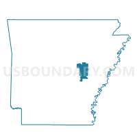
Center Voting District, Prairie County, Arkansas
About
Outline

Summary
| Unique Area Identifier | 527767 |
| Name | Center Voting District |
| County | Prairie County |
| State | Arkansas |
| Area (square miles) | 32.55 |
| Land Area (square miles) | 31.65 |
| Water Area (square miles) | 0.90 |
| % of Land Area | 97.22 |
| % of Water Area | 2.78 |
| Latitude of the Internal Point | 34.84585350 |
| Longtitude of the Internal Point | -91.64370770 |
Maps


Graphs
Select a template below for downloading or customizing gragh for Center Voting District, Prairie County, Arkansas


Neighbors
Neighoring Voting District (by Name) Neighboring Voting District on the Map
- CARLISLE RURAL Voting District, Lonoke County, AR
- Hazen TWP Voting District, Prairie County, AR
- TOTTEN Voting District, Lonoke County, AR
- Union Voting District, Prairie County, AR
Top 10 Neighboring County Subdivision (by Population) Neighboring County Subdivision on the Map
- Carlisle township, Lonoke County, AR (2,620)
- Hazen township, Prairie County, AR (1,772)
- Center township, Prairie County, AR (474)
- Totten township, Lonoke County, AR (423)
- Union township, Prairie County, AR (147)